DAY 3: Porcupine Rim 🚲 5.9.19 by Tara Scieszinski


pt. 1 🚲 

IG3.png

Porcupine Rim: pt. 1

May 9, 2019: PORCUPINE RIM | Moab, UT β€’ MTB 🚲

CLIMB: 2446 ft β€’ MILAGE: 20.3 mi


pt. 2

watch died.. PORCUPINE RIM Pt. II

CLIMB: 755 ft β€’ MILAGE: 10.1 mi


pt. 3 πŸ‘Ÿ 

PORCUPINE RIM Pt. III - post ride shakout from Slickrock into Moab

CLIMB: 67 ft β€’ MILAGE: 3.1 mi

RECAP DAY 3: CLIMB: 2446 + 755 + 67 = 3268 ft β€’ MILAGE: 20.3 + 10 + 3.1 mi = 33.4 mi

DAY 2: Canyonlands National Park πŸ‘Ÿ 5.8.19 by Tara Scieszinski


pt. 1 πŸ‘Ÿ

1.ShaferCanyonRd_1.jpg

Island in the Sky: pt. 1

May 8, 2019: NECK SPRING | Moab, UT β€’ hike πŸ‘Ÿ

photo: Shafer Road

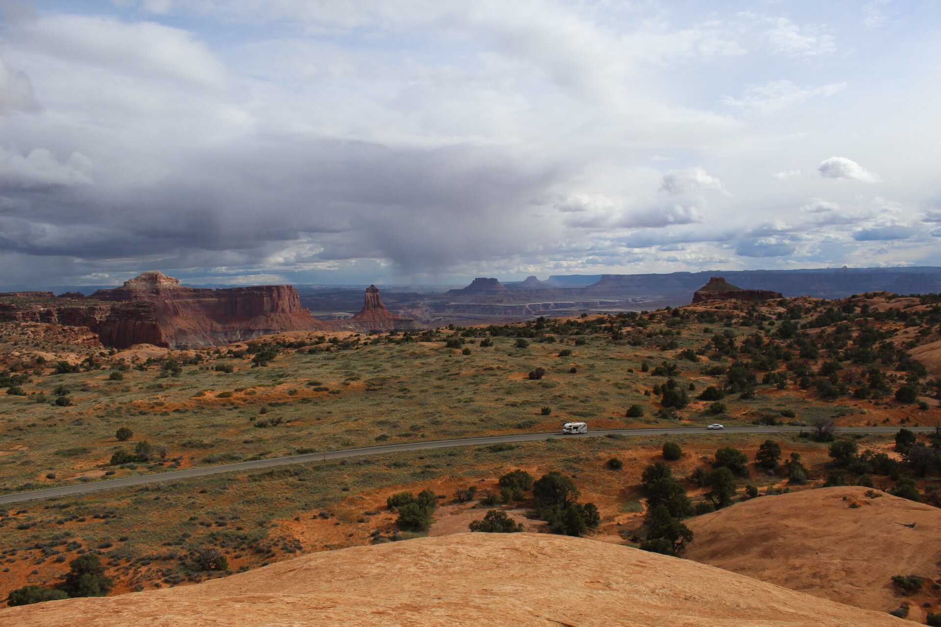
NECK SPRING + JUNCTION BUTTE -- Hike was average in terms of incline/decent and difficulty, pretty basic scenery but still got a good sweat on. Headed back toward the car to complete the loop, and stumbled upon one of the most amazing looking paths I have seen in my life. Shafer Road. Curvy. Endless.. Sexy. Dangerous. Oh how fun that would be by bike.

CLIMB: 854 ft β€’ MILAGE: 5.7 mi


pt. 2 πŸ‘Ÿ

2.MesaArch_1.jpg

Island in the Sky: pt. II

May 8, 2019: MESA ARCH | Moab, UT β€’ hike πŸ‘Ÿ

photo: Mesa Arch

CLIMB: 123ft β€’ MILAGE: .7mi


pt III πŸ‘Ÿ

3.JunctionButte_7.jpg

Island in the Sky: pt. III

May 8, 2019: GRANDVIEW POINT | Moab, UT β€’ hike πŸ‘Ÿ

photo: Junction Butte

CLIMB: 123ft β€’ MILAGE: 1.6mi


pt IV

4.WaleRock_1.JPG

Island in the Sky: pt. IV

May 8, 2019: WHALE ROCK | Moab, UT β€’ hike πŸ‘Ÿ

photo: Whale Rock

CLIMB: 238ft β€’ MILAGE: 2mi


pt V

5.UpheavalDome_1.jpg

Island in the Sky: pt. V

May 8, 2019: UPHEAVAL DOME | Moab, UT β€’ hike πŸ‘Ÿ

photo: Upheaval Dome

After experiencing Wale Rock, it felt like walking on a bunch of freshly discovered planets. Luckily got caught in a cove when a rain storm came through. It was almost euphoric the way the rain turned into hail and immediately started evaporating into the heat. We were dry minutes after.

CLIMB: 382ft β€’ MILAGE: 1.9mi

RECAP DAY 1:  TOTAL CLIMB: 854 + 123 + 123 + 238 + 382 = 1720 ft TOTAL MILAGE: 5.7 + .7 + 1.6 + 2 + 1.9 = 11.9 mi

DAY 1: Kokopelli Trail System πŸš²πŸƒπŸ»β€β™€οΈ 5.7.19 by Tara Scieszinski


pt. 1 🚲

*Kokopelli_IGframe.png

KOKOPELLI TRAIL SYSTEM: pt. 1

May 7, 2019: Loma, CO β€’ MTB 🚲

A mini tour of the best of the Kokopelli Trail system β€” accessible by multiple trailheads, intertwining segments, and many loops to ride forward, backward and as many times as you’d like.

We started at Wrangler and headed to Horse Thief Bench, up to the New Wrangler to the end of Mary’s Loop, over the saddle heading to Hawkeye. Hawkeye was designed and completed just months before in Feb 2019. We then rode Hawkeye to Mack Ridge, down Mack Ridge Road to Lions, east on Lions to Steve’s (CCW) to Mary’s and finish on old Wrangler. 26.2 miles of pure bliss.. until I decided to tackle a tree on Steve’s Loop.


pt. 2 πŸƒπŸ»β€β™€οΈ

day1_kokopelli2.png

KOKOPELLI TRAIL SYSTEM: pt. 2

May 7, 2019: Mack, CO β€’ RUN πŸƒπŸ»β€β™€οΈ

Shook out the legs for a brief run down gravel to the Hawkeye Trailhead, finished more than ready to chug an IPA... or 10. Day 1 βœ… βœ…

RECAP DAY 1:  TOTAL CLIMB: 2637 + 241 = 2878 ft β€’ TOTAL MILAGE: 26.2 + 3.1 = 29.3 mi

Delicate Arch | Moab, UT by Tara Scieszinski

52Β° F | very easy; slick rock terrain. need about 2 hours to take in the full view

DelicateArch_pano1.jpg