pt. 1 👟
Island in the Sky: pt. 1
May 8, 2019: NECK SPRING | Moab, UT • hike 👟
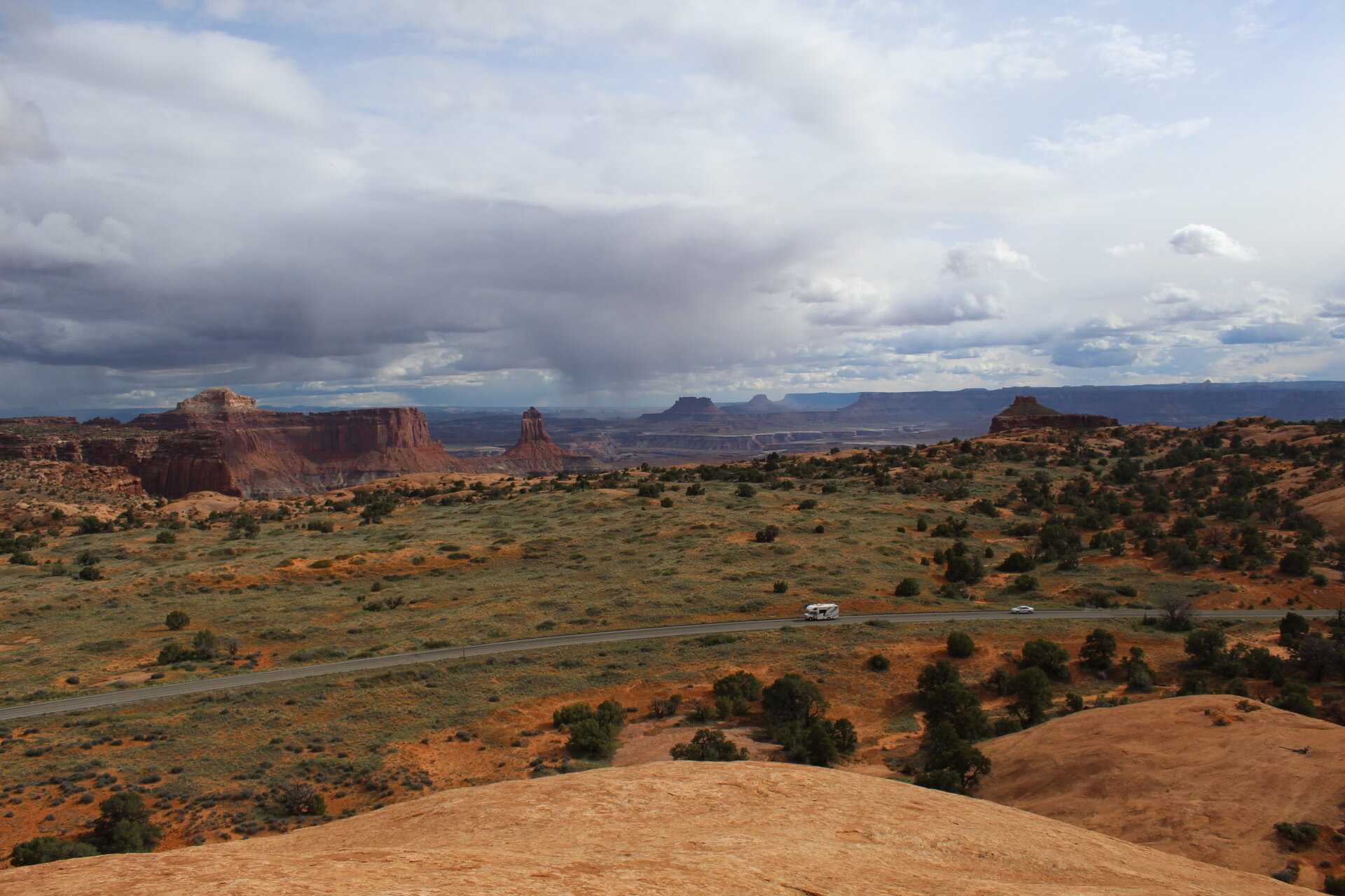
photo: Shafer Road
NECK SPRING + JUNCTION BUTTE -- Hike was average in terms of incline/decent and difficulty, pretty basic scenery but still got a good sweat on. Headed back toward the car to complete the loop, and stumbled upon one of the most amazing looking paths I have seen in my life. Shafer Road. Curvy. Endless.. Sexy. Dangerous. Oh how fun that would be by bike.
CLIMB: 854 ft • MILAGE: 5.7 mi
pt. 2 👟
Island in the Sky: pt. II
May 8, 2019: MESA ARCH | Moab, UT • hike 👟
photo: Mesa Arch
CLIMB: 123ft • MILAGE: .7mi
pt III 👟
Island in the Sky: pt. III
May 8, 2019: GRANDVIEW POINT | Moab, UT • hike 👟
photo: Junction Butte
CLIMB: 123ft • MILAGE: 1.6mi
pt IV
Island in the Sky: pt. IV
May 8, 2019: WHALE ROCK | Moab, UT • hike 👟
photo: Whale Rock
CLIMB: 238ft • MILAGE: 2mi
pt V
Island in the Sky: pt. V
May 8, 2019: UPHEAVAL DOME | Moab, UT • hike 👟
photo: Upheaval Dome
After experiencing Wale Rock, it felt like walking on a bunch of freshly discovered planets. Luckily got caught in a cove when a rain storm came through. It was almost euphoric the way the rain turned into hail and immediately started evaporating into the heat. We were dry minutes after.
CLIMB: 382ft • MILAGE: 1.9mi
RECAP DAY 1: TOTAL CLIMB: 854 + 123 + 123 + 238 + 382 = 1720 ft TOTAL MILAGE: 5.7 + .7 + 1.6 + 2 + 1.9 = 11.9 mi


